Delivering Excellence
photography &
drone services
Industrial surveys
Cinematic visuals


Professional drone services in the UK and EU
With over 9 years of experience our drone pilots offer unparalleled aerial cinematography services that capture breath taking footage from unique perspectives. From cinematic drone filming to aerial photography, surveys and inspections both onshore and offshore. We provide dynamic aerial footage that adds a vivid flair to TV shows, films, commercials, documentaries as well as covering all your PR and Marketing needs.

Drone Filming and Aerial Photography
Aerial Mapping

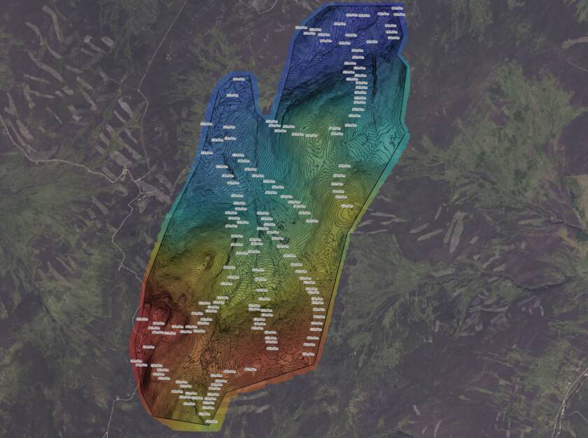
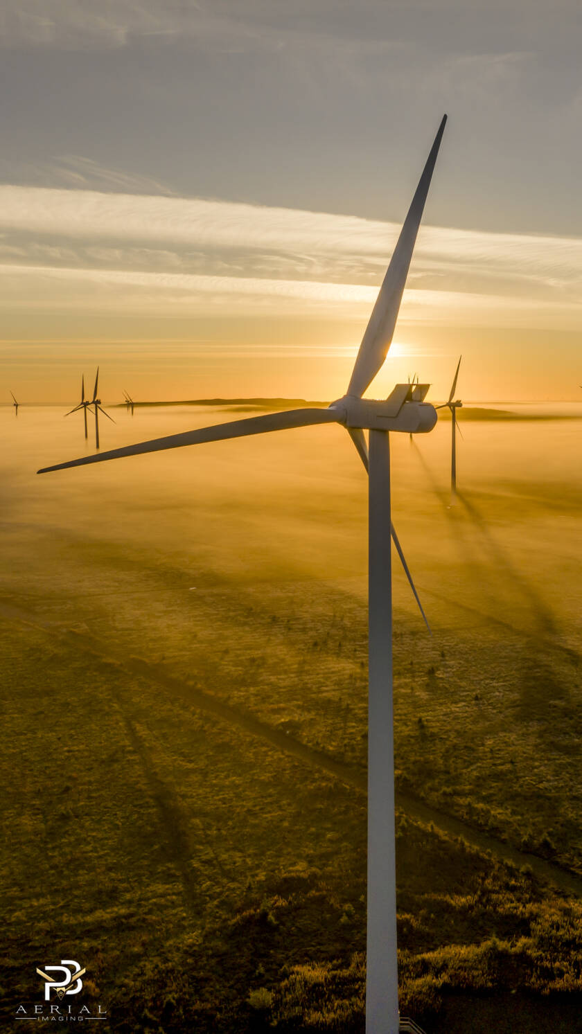
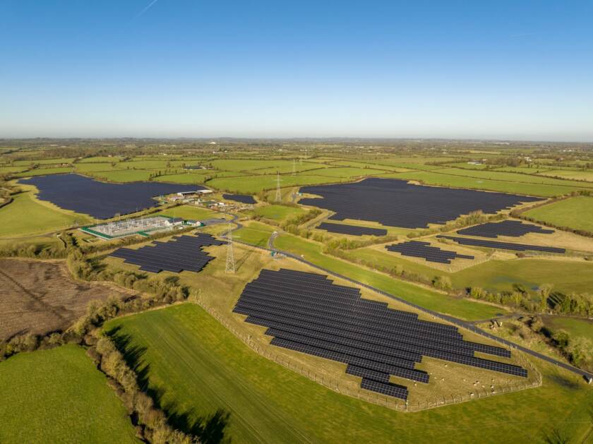
Offshore Renewable Energy
We hold full offshore certifications both O&G and GWO. Our Offshore drone pilots carryout full drone photography, aerial videography and drone thermal services to capture and showcase your installations, platforms and complete your asset inspection requirements. Including drone blade inspections, drone flare stack inspections and much more. We have vast experience of operating from CTVs, support vessels, jack up rigs, platforms and chartered vessels of all sizes and have operated in some of the most challenging harsh environments the UK waters have to offer as well as throughout Europe and Africa.
Marine Transport
We provide specialist marine filming services, capturing stunning aerial visuals across coastal and offshore environments. Whether it’s for commercial projects, inspections, or promotional content, our UAVs deliver high-resolution imagery with precision and stability, even in challenging marine conditions. Offering a safer, more efficient alternative to crewed shoots, we support the maritime sector with dynamic footage that showcases vessels, operations, and seascapes from a unique aerial perspective
Construction Industry
We offer professional construction drone filming services, capturing high-resolution aerial imagery for site surveys, progress tracking, construction site monitoring. inspections, and promotional use. Our UAVs provide a safer, faster, and more cost-effective alternative to traditional methods, helping project managers monitor construction site developments with real-time visuals. From residential builds to large-scale infrastructure, we deliver accurate, detailed footage that supports planning, reporting, and stakeholder engagement.
Oil & Gas Operators
We present specialist drone services for the oil and gas industry, capturing high-resolution aerial imagery for inspections, monitoring, and site overviews. Our UAVs offer a safer, faster, and more cost-effective alternative to traditional methods, reducing risk in hazardous or remote environments. From offshore platforms to refineries and pipelines, we deliver accurate visual data that supports maintenance planning, regulatory compliance, and operational efficiency across the energy sector.
Tourism Videography
We specialise in stunning tourism aerial filming that captures the beauty and essence of destinations from breathtaking aerial perspectives. Whether you’re a hotel, resort, tourism board, or travel brand, we create immersive drone videos that showcase landscapes, city attractions, and unique experiences. Our high-quality 4K footage enhances marketing campaigns, social media, and promotional materials, inspiring travelers and elevating your brand. Let us bring your destination to life with dynamic, cinematic aerial visuals.
Business Promotion
We create high-impact business promotion drone footage that elevates your brand with stunning aerial visuals. Our professional drone videos showcase your company, products, and services with dynamic 4K cinematography, perfect for marketing, social media, and corporate campaigns. Whether you need aerial shots for commercials, property showcases, events, or brand storytelling, we capture compelling footage that grabs attention and enhances engagement. Let us bring your business to life from a breathtaking new perspective.
Private and commercial aerial photography and videos, crafted with intelligence, precision and creativity
Paul Billany
Creative Director
Expert Drone Services Across the UK and Europe
With over nine years’ experience in aerial photography and videography, PB Aerial Imaging is your trusted partner for precision drone imaging tailored to your exact project needs.
Operating confidently in the toughest environments, from remote offshore platforms to complex construction sites, we deliver safe, efficient, and compliant drone solutions across the UK, Ireland, and throughout Europe. Utilising the latest drone technology and advanced sensors, we capture high-resolution, crystal-clear imagery and video — perfect for surveys, inspections, marketing campaigns, and more.
Our fully certified, GWO-qualified drone pilots specialise in the demanding offshore and industrial sectors, bringing more than eight years of hands-on offshore expertise to every flight.
Our commitment to safety, regulatory compliance, and industry best practices means you can rely on PB Aerial Imaging for consistently professional results. Trusted by major players in energy, construction, infrastructure, along with TV, Film and Media, we elevate your projects with dependable, high-quality aerial data and visuals — no matter the challenge or location.