
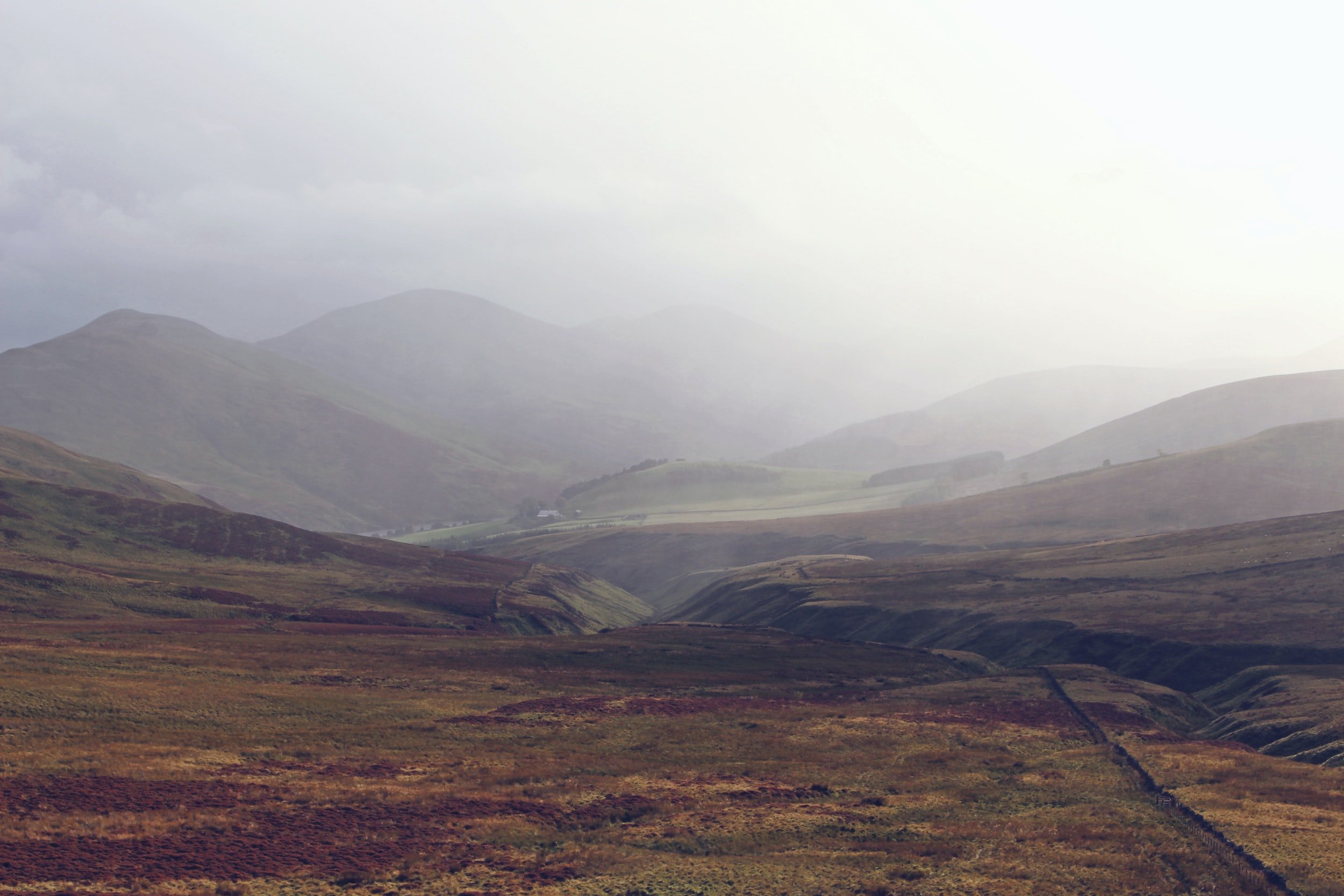
Peatland Resoration Surveys
“Peatlands are a unique and important ecosystem, covering approximately 3% of the earth’s surface and containing approximately 30% of the world’s soil carbon. However, due to factors such as agriculture, forestry, and mining, peatlands have been severely degraded, leading to negative impacts on the environment and climate change. Restoration of degraded peatlands is essential to mitigate these impacts and ensure the continued functioning of this ecosystem. The use of drones for peatland restoration has emerged as a promising approach to help in the restoration process.”
One of the main challenges in peatland restoration is the need for accurate and up-to-date mapping of the area. Traditional mapping techniques are often labor-intensive, time-consuming, and costly, making it difficult to obtain accurate information on the extent and severity of peatland degradation. Drones, however, offer a faster, cheaper, and more accurate solution to mapping peatlands.
Using drones for peatland restoration has several benefits, including:
Aerial Surveying: Drones can be equipped with high-resolution cameras and sensors to create detailed maps of peatland areas. This information can be used to identify areas of damage, monitor progress, and plan restoration efforts.
Time and Cost Effective: Traditional methods of surveying and mapping peatlands can be time-consuming and costly. Drones are a more efficient and cost-effective way to survey large areas of land.
Precision: Drones can fly at low altitudes and capture high-resolution images, allowing for precise mapping and analysis of peatland areas. This helps to identify the specific areas that need restoration and ensure that resources are used effectively.
Accessibility: Peatlands are often remote and difficult to access, making it challenging to monitor and restore them. Drones can access these areas easily and safely, allowing for more comprehensive monitoring and restoration efforts.
Environmental Impact: Drones are a more environmentally friendly option for peatland restoration than traditional methods. They produce fewer emissions and disturbances to wildlife and vegetation.

Digital Surface Model
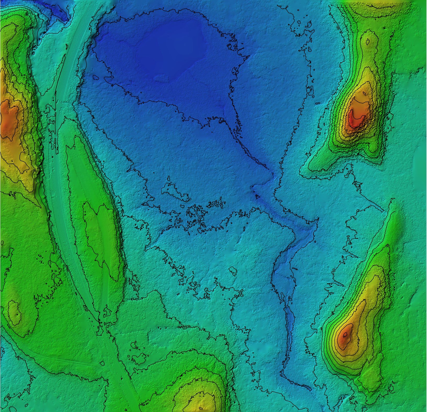
Digital Terrain Model with 1m Contours

Orthomosaic 1.8cm/px GSD
The accuracy of drone surveys for peatland restoration projects depends on several factors, including the type of drone, the quality of the sensors and cameras used, the altitude and speed of the drone, and the processing methods used to generate the final map or model.
In general, drones equipped with high-quality sensors and cameras can capture images with a resolution of a few centimeters per pixel. This level of detail can be used to generate accurate maps of the peatland area, including identifying areas of damage and measuring the extent of restoration efforts.
Additionally, drone surveys can be flown with RTK and combined with ground-based surveys and Ground Control Points etc along with other data sources can vastly improve the absolute accuracy of the results.
The accuracy of drone surveys can also be affected by external factors such as weather conditions and the presence of obstacles such as trees or buildings. However, we use advanced mapping software and techniques to correct for these factors and improve the accuracy of the final map.
Overall, using drones for peatland restoration can increase the efficiency and effectiveness of restoration efforts, while minimizing the environmental impact of those efforts
For example, in the UK, the University of Stirling, in collaboration with Forest Research and the Scottish government, used drones to map peatland areas in the Flow Country, a large peatland region in the north of Scotland. The drones were equipped with high-resolution cameras and used to capture aerial images of the area. These images were then processed using advanced image analysis techniques to create detailed maps of the peatland, including information on vegetation cover, peat depth, and water content. The resulting maps allowed researchers to identify areas of degraded peatland and prioritize restoration efforts.
In addition to mapping, drones can also be used to monitor peatland restoration activities.
For example, in Finland, the Natural Resources Institute Finland (Luke) used drones to monitor the restoration of a peatland area that had been damaged by forestry activities. The drones were equipped with thermal cameras, which allowed researchers to detect changes in temperature caused by restoration activities such as the blocking of drainage ditches. The data collected by the drones was used to assess the effectiveness of restoration efforts and make adjustments as needed.
Another use of drones in peatland restoration is the application of herbicides to control invasive plant species. Invasive plant species can be a significant problem in degraded peatlands, competing with native vegetation and hindering restoration efforts. Drones can be used to apply herbicides to specific areas, reducing the risk of herbicide drift and minimizing the impact on non-target species.
For example, in the United States, the U.S. Fish and Wildlife Service used drones to apply herbicides to invasive plant species in a peatland area in Minnesota. The use of drones allowed for precise targeting of the herbicide, reducing the impact on native vegetation and minimizing the risk of herbicide drift.
Overall, the use of drones in peatland restoration has the potential to significantly improve the efficiency, accuracy, and cost-effectiveness of restoration activities. By providing detailed mapping information, monitoring restoration activities, delivering materials and equipment, and applying herbicides to invasive plant species, drones can help to ensure the successful restoration of degraded peatlands. However, there are also potential drawbacks and challenges to consider when using drones in peatland restoration.
It's essential to work with a professional drone operator who has experience in mapping and surveying peatland areas and who can provide accurate and reliable data for restoration efforts.